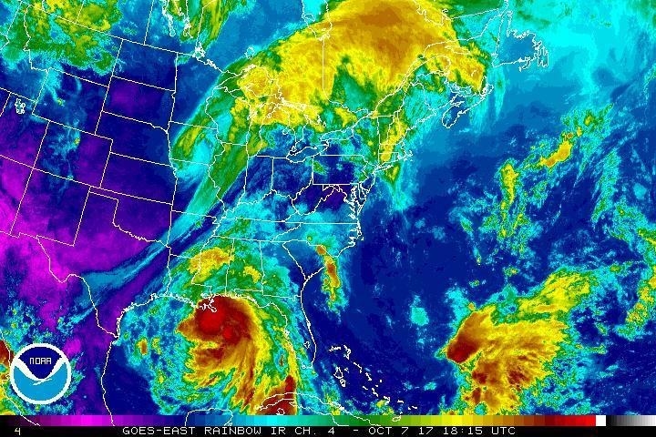
Hurricane Nate in the Gulf of Mexico on Saturday, Oct. 7, 2017 at 2:15 p.m. ET. NOAA / AP
What We Know So Far
- As of Saturday afternoon, Nate is a Category 1 hurricane with maximum sustained winds of 90 mph.
- While a tropical storm, Nate was responsible for the deaths of at least 21 people in Central America and dozens are still missing.
- Nate is expected to make landfall in the US on Saturday night, prompting states of emergency in Louisiana, Mississippi, and Alabama.
- The mayor of New Orleans instituted a mandatory curfew for Saturday night and has begun evacuations in areas of the city that could see major storm surges.
Updates
The outer bands of Hurricane Nate, which is projected to be a category two hurricane when it makes landfall on Saturday night, are already hitting New Orleans, with wind gusts up to 45 mph.
The National Weather Service warned in a tweet that “conditions will deteriorate quickly this afternoon.”
The first outer band of Hurricane #Nate is approaching the New Orleans metro. Conditions will deteriorate quickly t… https://t.co/YE2KYQX3bv
— NWS New Orleans (@NWSNewOrleans)
A hurricane watch remains from Grand Isle, Louisiana, to the Alabama/Florida border, and includes metropolitan New Orleans. Photos and videos by Louisiana locals show the grey clouds of the first hurricane band.
First band of #Nate
— Hank Allen (@HankAllenWX)
Timelapse of that first squall from Hurricane #Nate. Violet, Louisiana. #LAwx @WWLTV
— Cory Reppenhagen (@CReppWx)
At 1 P.M. CT, the eye of Nate was 105 miles “south of the mouth of the Mississippi River,” tweeted the National Weather Service for New Orleans.
The latest report from the National Hurricane Center notes that “the center of Nate will approach the mouth of the Mississippi during the next several hours and will make landfall along the central U.S. Gulf Coast tonight.”
It also warns that storm surges between the mouth of the Mississippi and the Mississippi/Alabama border could reach up to 11 feet, and up to nine feet between the Mississippi/Alabama border and the Alabama/Florida border.
“The deepest water will occur along the immediate coast near and to the east of the landfall location, where the surge will be accompanied by large and destructive waves,” warned the NHC.
Hurricane #Nate continues on approach to the central Gulf Coast #LAwx #MSwx https://t.co/RHpWwT5JIX… https://t.co/5hrnKVAUlS
— NWS New Orleans (@NWSNewOrleans)
Nate gathers strength over the Gulf of Mexico and is expected to be a Category 2 when it makes landfall in the US
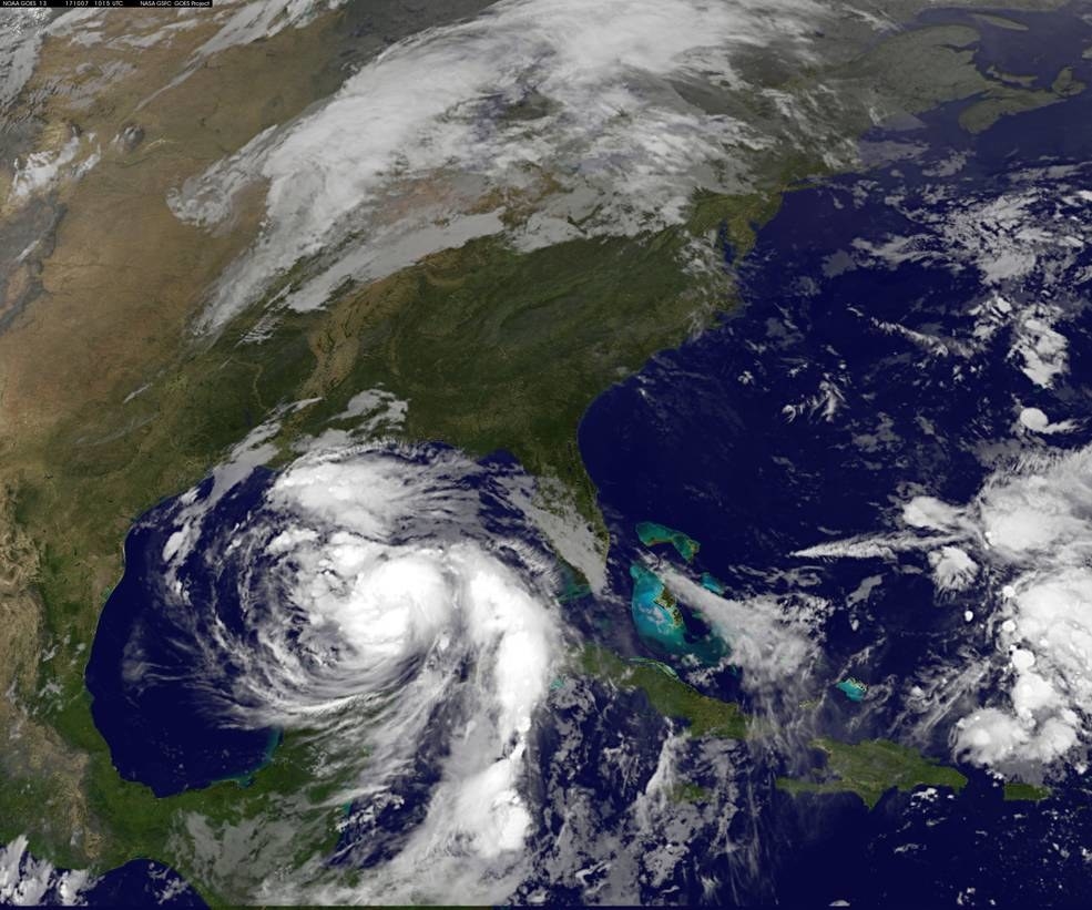
Hurricane Nate on October 7, 2017. NASA
The National Hurricane Center said on Saturday morning said Nate “is a little stronger over the central Gulf of Mexico.”
The storm is traveling at a quick 22 mph and is not expected to slow down, and is now expected to be a Category 2 hurricane when it makes landfall in the US.
—Gavon Laessig
Sunrise imagery of #HurricaneNate this morning, our 9th hurricane of the record breaking season so far. More loops… https://t.co/G6vV1oPiC2
— NOAA Satellites (@NOAASatellites)


